Explore a different side of the city on this Fortezza da Basso Walking Tour, following the northern edge of historic Florence from one of the Medici period’s most imposing fortifications into an area shaped by city walls, railway development, nineteenth-century boulevards and modern urban life.
This route deliberately moves away from Florence’s most familiar Renaissance landmarks. Instead, it reveals how the city defended itself, expanded beyond its walls and gradually developed into the Florence we see today. It is a walk for visitors who want to understand the city rather than simply move between its famous monuments.
🚶 At a Glance
Distance:
Walking time:
Recommended time:
Start:
Finish:
Character: Medici fortifications · City walls · Gardens · Urban history · Northern Florence
Difficulty:
Walking Route Map
The map will show the final route around the Fortezza da Basso and through northern Florence, together with the numbered stops described below.
🗺️ Walking Route Map
[WP Go Maps route will be added here]
The Walking Tour
1. Piazza della Stazione
Begin near Santa Maria Novella railway station, one of the most important points of arrival in modern Florence. Although thousands of visitors pass through the area every day, relatively few stop to consider how dramatically the railway changed this part of the city.
The station belongs to a much later Florence than the nearby Renaissance churches and palaces. Its modern architecture and busy forecourt provide an appropriate starting point for a walk concerned with the city’s expansion and transformation.
👀 Firenze Casa Tip
Before leaving the station area, look back towards Santa Maria Novella and then towards the modern transport infrastructure around you. Few places demonstrate the coexistence of historic and modern Florence so clearly.
2. Palazzina Reale
Close to the station stands the Palazzina Reale, a striking example of twentieth-century architecture. Designed as a royal reception building, it reflects a period of Italian architectural history that visitors to Florence often overlook.
Its restrained modern language contrasts sharply with the Renaissance image normally associated with the city. This contrast introduces one of the themes of the walk: Florence continued to develop architecturally long after the age of the Medici.
3. Fortezza da Basso
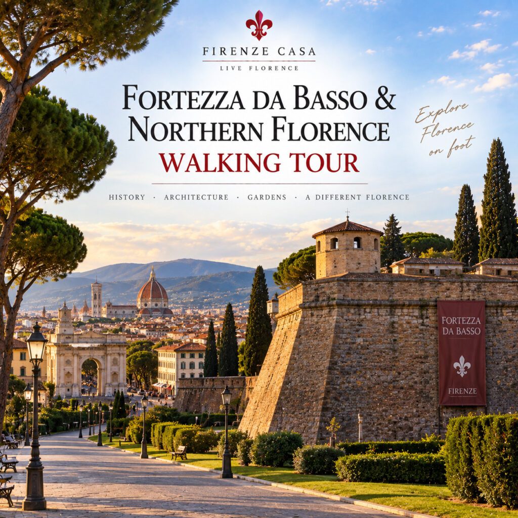
The Fortezza da Basso dominates the northern side of central Florence. Commissioned by Alessandro de’ Medici in the sixteenth century, the fortress was designed by Antonio da Sangallo the Younger and represented a new generation of military architecture adapted to artillery warfare.
Its massive bastions and geometric plan were very different from the medieval walls that had previously protected Florence. The fortress was not only intended to defend the city from external attack. Its scale and position also expressed Medici authority over Florence itself.
Today the complex is closely associated with exhibitions, trade fairs and major events, but its military origins remain clearly visible from outside.
🏰 Power in Stone
The Fortezza da Basso was more than a defensive structure. Its imposing bastions also communicated the political power of the Medici at a moment when ducal authority was being consolidated in Florence.
4. Walk Around the Fortress
Continue around the exterior of the Fortezza rather than treating it as a single monument. Walking beside its walls makes the enormous scale of the complex much easier to appreciate.
Notice the low, angular bastions. Renaissance military engineers increasingly abandoned tall medieval walls because artillery made them vulnerable. Lower and thicker fortifications with projecting bastions allowed defenders to control the ground around the fortress more effectively.
🧱 Architecture to Notice
Compare the Fortezza with Florence’s surviving medieval gates and towers. The difference in height and geometry reflects a fundamental change in warfare after the introduction of increasingly powerful artillery.
5. Fortezza Gardens
The green spaces surrounding the fortress soften what was once a deliberately intimidating military landscape. Today they form part of the northern urban belt between the historic centre and the neighbourhoods beyond.
This contrast between fortification and public green space reflects the changing function of Florence’s former defensive perimeter. Areas once designed to separate and protect the city gradually became integrated into everyday urban life.
6. Viale Filippo Strozzi
Continue along the broad avenues surrounding the Fortezza. Their scale immediately feels different from the narrow streets inside the historic centre.
These avenues belong to the transformation of Florence during the nineteenth century, when large sections of the old city walls were demolished and replaced by boulevards. The project formed part of the modernisation of Florence during the years surrounding its role as capital of the Kingdom of Italy.
🗺️ Reading Florence
When you encounter Florence’s broad ring avenues, imagine the medieval walls that once occupied approximately this urban boundary. Their course still helps explain the shape of the historic centre today.
7. Piazza della Libertà
Piazza della Libertà marks one of the most important transitions between historic Florence and the city that expanded northwards. Its broad circular form belongs largely to nineteenth-century urban planning, but older structures survive within it.
The square demonstrates how Florence incorporated fragments of its medieval past into a modern road system rather than erasing every trace of the former city boundary.
8. Porta San Gallo
Porta San Gallo is one of the surviving gates of Florence’s medieval walls. For centuries, travellers approaching from the north entered the city through this gateway.
The gate provides a striking contrast with the Fortezza da Basso. Porta San Gallo belongs to the medieval concept of a walled city with controlled entrances, while the Fortezza represents the very different military technology and political circumstances of the sixteenth century.
🚪 Gateway to Florence
Imagine arriving here before the nineteenth-century boulevards existed. Porta San Gallo was not an isolated monument in a traffic circle but part of a continuous defensive wall separating Florence from the countryside.
9. The Triumphal Arch of the Lorraine
Standing near Porta San Gallo, the eighteenth-century triumphal arch introduces yet another historical layer. It was erected in connection with the arrival of the Habsburg-Lorraine dynasty after the end of Medici rule.
The medieval gate and later ceremonial arch stand close together, turning Piazza della Libertà into a compact lesson in Florentine political history. Different ruling periods have left their architectural marks within the same urban space.
10. Parterre
The Parterre provides a greener pause on the northern edge of the historic centre. Its gardens and open spaces contrast with both the dense streets to the south and the busy avenues surrounding Piazza della Libertà.
The area illustrates how former peripheral zones of Florence were gradually transformed into public and recreational spaces as the city expanded beyond its old defensive limits.
11. Via San Gallo
Turn south towards the historic centre along Via San Gallo, an ancient route connecting the northern gate with the heart of Florence. Walking this street reverses the journey once made by travellers entering the city from the north.
Churches, former religious institutions, palaces and more modest buildings line the route. The gradual increase in density as you move south provides a sense of how the medieval city developed along its principal streets.
12. Sant’Apollonia
The area around Sant’Apollonia introduces the religious and artistic history of northern central Florence. The former Benedictine convent is particularly associated with Andrea del Castagno and his celebrated Last Supper.
Sites such as this demonstrate how significant works of Renaissance art can be found beyond Florence’s most famous museums. They also preserve traces of the extensive network of convents and monasteries that once shaped entire sections of the city.
🎨 A Quieter Renaissance
Northern Florence contains important Renaissance sites that receive far fewer visitors than the Duomo or Uffizi. Sant’Apollonia is a good example of how rewarding it can be to explore beyond the principal tourist routes.
13. Piazza San Marco
Piazza San Marco brings the walk back into one of the historically important areas of central Florence. The square is associated with the Dominican complex of San Marco, the Medici, Fra Angelico and the turbulent religious career of Girolamo Savonarola.
It also forms an important urban junction between the historic centre and northern Florence. From here, routes lead south towards the Duomo, west towards San Lorenzo and north towards Piazza della Libertà.
14. Return towards the Fortezza
From San Marco, the route can return towards the Fortezza through the northern streets of the historic centre. This final section reconnects the religious and residential city with the military and infrastructural landscapes encountered earlier.
By the end of the walk, the Fortezza no longer appears as an isolated monument. It becomes part of a much larger story involving medieval walls, Medici rule, nineteenth-century expansion, railway development and the transformation of Florence into a modern city.
Optional Detours
Orto Botanico
Near San Marco lies Florence’s historic botanical garden, traditionally known as the Giardino dei Semplici. Created in the sixteenth century for the study of medicinal plants, it offers a green extension to the walk and another connection with Medici Florence.
Chiostro dello Scalzo
A short detour leads to the Chiostro dello Scalzo, known for Andrea del Sarto’s remarkable monochrome fresco cycle. It is another example of an important Renaissance site hidden within the quieter streets of northern central Florence.
San Marco
Visitors interested in Renaissance painting and religious history can extend the walk with a visit to the Museum of San Marco. Fra Angelico’s frescoes and the rooms associated with Savonarola make the former Dominican convent one of Florence’s most significant historic complexes.
Where to Pause Along the Way
The green spaces around the Fortezza provide a natural first pause and allow time to appreciate the scale of the fortifications from different angles.
Piazza della Libertà is worth exploring slowly rather than simply crossing. The medieval gate, triumphal arch and nineteenth-century urban layout can only really be understood when considered together.
The Parterre offers a quieter green break before returning towards the historic centre, while the area around San Marco provides numerous possibilities for a final pause.
Make This Walk Your Own
Visitors primarily interested in military history can concentrate on the Fortezza da Basso, its bastions and the surviving traces of Florence’s former defensive system. Comparing the fortress with Porta San Gallo makes the transition from medieval to Renaissance fortification particularly clear.
For those interested in urban history, continue towards Piazza della Libertà and pay particular attention to the broad avenues. This version of the walk reveals how nineteenth-century planners transformed the former perimeter of the walled city.
Art lovers can devote more time to the return through Via San Gallo, Sant’Apollonia and San Marco. These streets contain an extraordinary concentration of religious and artistic history without the intensity of Florence’s busiest monumental areas.
🚶 A Different Florence
This is not primarily a walk of famous postcard views. Its reward is understanding how Florence changed: from medieval walled city to Medici stronghold and eventually to a modern urban centre extending far beyond its historic boundaries.
Why This Walk Is Worth It
The Fortezza da Basso & Northern Florence Walking Tour explores a part of the city that many visitors encounter without really seeing. Railway stations, busy avenues and traffic can disguise an area containing important evidence of Florence’s military, political and urban history.
The Fortezza da Basso reveals the power and defensive thinking of sixteenth-century Medici Florence. Porta San Gallo preserves the memory of the medieval city walls, while Piazza della Libertà and the surrounding boulevards document the dramatic nineteenth-century expansion of the city.
The return through Via San Gallo and San Marco then reconnects this urban story with Renaissance art and religious history. Together, these different layers make northern Florence particularly rewarding for anyone who wants to understand how the city developed beyond the familiar image of the Renaissance centre.
Further Reading on Firenze Casa
Internal links to related Firenze Casa articles will be added here after completion of the Walking Tours cluster.
References
- Comune di Firenze – historical information on the Fortezza da Basso, Florence’s city walls and nineteenth-century urban development.
- FeelFlorence – historical and visitor information on the Fortezza da Basso, Piazza della Libertà and northern Florence.
- Musei Civici Fiorentini – historical and artistic information relating to Florence’s monuments and urban development.
- Università degli Studi di Firenze – historical information on the Botanical Garden and the northern university district.
- UNESCO – historical documentation on the Historic Centre of Florence.