
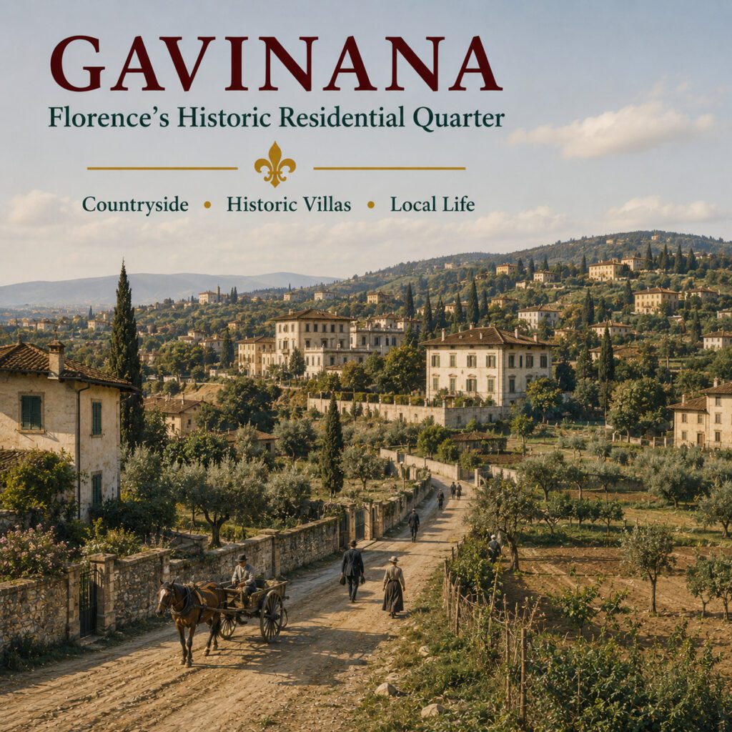
Gavinana in Florence is a residential neighbourhood whose history connects the expanding modern city with an older landscape of roads, farms, villas and settlements south of the Arno. Unlike the medieval quarters around Santa Croce or Santo Spirito, much of Gavinana took shape as Florence expanded beyond its historic boundaries during the nineteenth and twentieth centuries.
Its name also carries an unexpected historical story. Gavinana in Florence was not the site of the famous Battle of Gavinana in 1530. Instead, Piazza Gavinana was named in memory of that battle and the Florentine commander Francesco Ferrucci, linking the modern neighbourhood symbolically with one of the dramatic final episodes of the Florentine Republic.
Gavinana lies southeast of Florence’s historic centre on the southern side of the Arno. The neighbourhood developed largely during the nineteenth and twentieth centuries around older settlements such as Ricorboli and along the historic road towards Ripoli. Today it combines residential streets, historic villas, parks and a strong local identity.
Where Is Gavinana?
Gavinana occupies part of southeastern Florence between the Arno and the hills that rise towards the south and east of the city. It belongs to an urban landscape that gradually merges with areas such as Ricorboli, Bandino, Sorgane and the routes towards Bagno a Ripoli.
The district lies outside Florence’s medieval core. This geographical position explains much of its history, because the area remained relatively rural long after neighbourhoods closer to the centre had become densely urbanised.
Today, broad streets and residential buildings dominate much of Gavinana. Yet older churches, villas, walls and historic routes still reveal the landscape that existed before modern Florence expanded across the area.
Why Is the Neighbourhood Called Gavinana?
The name can easily cause confusion. Gavinana is also a village in the mountains of the Pistoia area, and it was there that one of the decisive battles of the Siege of Florence took place on 3 August 1530.
The Florentine neighbourhood did not exist under this name at the time of the battle. Its modern name derives from Piazza Gavinana, which commemorates the historic confrontation and the defence of the Florentine Republic.
This nineteenth- and twentieth-century commemorative geography appears throughout the surrounding streets. Several names recall figures from Florentine medieval and Renaissance history, particularly military commanders, humanists and personalities associated with the city’s past.
The Battle of Gavinana did not take place in this Florence neighbourhood. It was fought in the mountain village of Gavinana near San Marcello Pistoiese, more than 40 kilometres from Florence. The neighbourhood’s name commemorates the battle rather than identifying its location.
The Battle of Gavinana and Francesco Ferrucci
The Battle of Gavinana took place during the final phase of the Siege of Florence in 1530. Imperial and papal forces sought to defeat the Florentine Republic and restore Medici rule, while Florentine troops continued their resistance under increasingly difficult circumstances.
Francesco Ferrucci became one of the most celebrated commanders of the republican defence. His relief expedition was intercepted at Gavinana on 3 August 1530, where a fierce battle developed between the Florentine and imperial forces.
Ferrucci was captured after the fighting and killed by the condottiere Fabrizio Maramaldo. The Florentine Republic capitulated shortly afterwards, and Ferrucci eventually became a powerful symbol of resistance and civic courage.
Francesco Ferrucci’s connection with modern Gavinana is commemorative rather than geographical. Piazza Gavinana and nearby place names preserve the memory of the republican commander and the final struggle against the restoration of Medici power.
Before Gavinana Became a City Neighbourhood
For centuries, the landscape southeast of Florence consisted largely of agricultural land, scattered houses, religious buildings and villas. Roads crossed this countryside on their way from Florence towards Ripoli and settlements beyond the city.
One of the most important historic routes was Via di Ripoli. Its medieval course provided a framework around which later development could take place, while smaller roads connected farms, churches and villas throughout the surrounding countryside.
Ricorboli formed one of the older settlements in this landscape and is documented centuries before the emergence of modern Gavinana. The gradual absorption of such historic nuclei into expanding Florence created the layered neighbourhood visible today.
Ricorboli and the Older Landscape
Ricorboli is essential for understanding the origins of Gavinana. Long before the modern street grid appeared, this area formed part of the inhabited countryside outside Florence.
The Church of Santa Maria a Ricorboli preserves the memory of this older community. The present church largely dates from the early twentieth century and replaced an earlier building, while elements of the historic religious site survived the reconstruction.
The surrounding area demonstrates how Florence expanded by incorporating existing settlements rather than simply building on empty land. Older roads and landmarks became embedded within a new urban neighbourhood.
Gavinana may appear modern at first glance, but its street pattern contains traces of a much older landscape. Historic routes such as Via di Ripoli and settlements such as Ricorboli existed long before the surrounding residential district.
Firenze Capitale and the Expansion South of the Arno
The transformation accelerated after Florence became capital of the Kingdom of Italy in 1865. The city suddenly required new housing, roads and infrastructure for a rapidly changing population and administration.
Giuseppe Poggi’s urban plans reshaped large parts of Florence. Although the most dramatic interventions occurred around the former city walls and the Viali di Circonvallazione, the effects extended well beyond those areas.
Development began spreading into the countryside around Ricorboli. By the late nineteenth and especially the early twentieth century, villas, middle-class houses and more modest residential buildings were creating the foundations of modern Gavinana.
Gavinana belongs to the story of Florence after the medieval walls ceased to define the city. Its growth illustrates how former countryside gradually became part of a larger modern Florence.
Piazza Gavinana – The Centre of the New District
Piazza Gavinana emerged as a central point within the developing neighbourhood. Roads converged around the square as residential construction spread through the surrounding area.
The piazza gave the wider district the name by which it is commonly known today. Its historical reference to the Battle of Gavinana also placed the new neighbourhood within a wider culture of commemorating figures and events from Florence’s past.
This combination is characteristic of modern urban expansion. A relatively new district acquired historical identity through names recalling the much older history of the city.
Francesco Ferrucci in the Streets of Gavinana
The memory of Francesco Ferrucci extends beyond the neighbourhood’s name. Nearby streets and public spaces reflect the importance assigned to the republican commander in later interpretations of Florentine and Italian history.
Ferrucci became particularly prominent during the nineteenth century, when episodes of resistance and civic independence from Renaissance history were reinterpreted through the political culture of the Risorgimento.
For the developing district, these historical references provided more than convenient street names. They connected modern urban Florence with narratives of republican courage and national identity.
Villa di Rusciano
One of the most important reminders of the older landscape is Villa di Rusciano. The villa stands in the hills above the neighbourhood and is traditionally associated with Luca Pitti and the architectural culture of fifteenth-century Florence.
Its presence demonstrates that the area was never simply empty countryside. Wealthy Florentine families established villas beyond the dense city, combining agricultural estates with residences offering air, space and views.
As Florence expanded, buildings that had once occupied rural settings became increasingly surrounded by the modern city. Villa di Rusciano therefore represents an important link between Renaissance Florence and the later neighbourhood.
Before Gavinana became a residential district, the surrounding countryside contained villas belonging to wealthy Florentine families. Urban expansion eventually brought the city to landscapes that had once stood well beyond its dense centre.
The Bandino
The Bandino preserves another historic layer within the wider Gavinana area. Its identity developed around older buildings and Villa del Bandino, long before twentieth-century urbanisation transformed the surrounding landscape.
Parts of the area still contain narrow streets, walls and architectural details that recall its earlier rural character. These fragments contrast strongly with the broader roads and apartment buildings of modern Gavinana.
The Grotta del Bandino, created during the eighteenth century, also reflects the culture of ornamental grottoes found in Tuscan villa gardens. Such features remind visitors that the district contains more architectural history than its modern appearance initially suggests.
Villa Il Tasso and Roberto Longhi
The hills around Gavinana also became associated with the influential art historian Roberto Longhi. Villa Il Tasso was his Florentine home and later became closely connected with the foundation preserving his scholarly legacy.
Longhi was one of the major Italian art historians of the twentieth century. His research profoundly influenced the study of artists including Caravaggio, Piero della Francesca and painters of the Italian Renaissance.
The presence of Villa Il Tasso adds an unexpected cultural dimension to Gavinana. The neighbourhood’s history therefore extends from rural estates and nineteenth-century expansion to modern scholarship and the study of Italian art.
Gavinana in the Early Twentieth Century
Urbanisation intensified during the first decades of the twentieth century. New streets followed a more regular pattern than the winding roads of medieval Florence, while villas and apartment buildings accommodated the growing population.
Housing varied considerably. Some streets contained attractive villini intended for middle-class residents, while other developments provided more modest accommodation for workers and families.
The result was a mixed residential district rather than a monumental urban centre. Gavinana developed around everyday requirements such as housing, schools, shops, transport and public services.
Gavinana was designed primarily for people to live in rather than for visitors to admire. That distinction remains fundamental to its character today.
The Arno and the Eastern Edge of Florence
The Arno forms an important geographical reference for northern Gavinana. The river separates the district from areas on the opposite bank while bridges connect it with Campo di Marte and eastern Florence.
Ponte San Niccolò provides the historic connection closest to the centre, while Ponte Giovanni da Verrazzano became an important modern crossing further east. These bridges helped integrate the growing southern districts into the wider city.
The river also shaped recreational space. Today, green areas along the Arno provide a very different environment from the dense streets of central Florence.
Albereta and Anconella
The parks of Albereta and Anconella form one of the most important green areas in southeastern Florence. Situated close to the Arno, they provide space for walking, cycling, sport and everyday recreation.
The landscape reinforces Gavinana’s character as a residential district with greater access to open space than many neighbourhoods closer to the historic centre. Trees and riverside paths create a transition between the built city and the Arno.
These parks also play an important social role. They are used primarily by residents, making them good places to observe the rhythms of contemporary Florentine life away from major tourist routes.
Combine a walk through Gavinana with the Albereta and Anconella parks. The route reveals both the residential neighbourhood and the greener landscape along the eastern Arno.
The Florence Flood of 1966
Gavinana suffered severely during the catastrophic Florence flood of 4 November 1966. Water from the Arno spread through low-lying parts of the district and affected homes, businesses and infrastructure.
The disaster was not limited to the famous historic centre. Residential neighbourhoods along the river experienced enormous damage, reminding us that the flood was first and foremost a human catastrophe for Florentines throughout the city.
Memories of 1966 remain part of local history in Gavinana. They connect the neighbourhood with one of the defining events of twentieth-century Florence.
Photographs of the 1966 flood often focus on Santa Croce and Florence’s monuments. Gavinana and other residential districts were also badly affected, and thousands of ordinary Florentines faced flooded homes and workplaces.
Gino Bartali and Gavinana
Gavinana also has an association with one of Florence’s most beloved sporting figures, cyclist Gino Bartali. Born in nearby Ponte a Ema, Bartali remained closely linked with southeastern Florence throughout his life.
His achievements in the Giro d’Italia and Tour de France made him an international sporting hero. His activities during the Second World War later added another remarkable dimension to his reputation.
Today, his name appears prominently in the area, reinforcing the connection between Gavinana and the wider southeastern landscape of Florence in which Bartali grew up and lived.
Industry and the Changing Neighbourhood
Twentieth-century Gavinana was not exclusively residential. Industrial and commercial activities occupied significant areas, particularly as Florence continued to expand towards the southeast.
Over time, many factories and workshops closed or relocated. Former industrial sites were redeveloped for housing, shops and larger commercial complexes, altering the neighbourhood once again.
This process reflects a wider transformation across European cities. Districts that once combined residential and industrial functions increasingly shifted towards services, retail and housing.
Viale Europa and Modern Gavinana
Viale Europa represents a later phase in the expansion of southeastern Florence. Broad roads, larger residential developments and commercial buildings contrast with the older fabric around Ricorboli and Via di Ripoli.
As development continued during the post-war decades, the urban area extended towards Sorgane, Ponte a Ema and the municipal boundary with Bagno a Ripoli.
Modern Gavinana therefore contains several distinct historical layers. Older rural routes, early twentieth-century residential streets and later urban development coexist within the same broad neighbourhood.
What Is Gavinana Like Today?
Today, Gavinana is predominantly a residential part of Florence. Shops, cafés, schools, markets, parks and everyday services cater mainly to local residents rather than visitors.
The atmosphere differs significantly from the historic centre. Tourism is less dominant, streets are generally broader and daily routines remain more visible than around Florence’s major monuments.
At the same time, central Florence is relatively close. This combination allows Gavinana to function as a local neighbourhood while remaining strongly connected with the rest of the city.
Gavinana is not a neighbourhood built around a single attraction. Its appeal lies in the combination of residential streets, older historical fragments, parks and the everyday life of modern Florence.
Gavinana Compared with Florence’s Historic Quarters
Gavinana differs fundamentally from neighbourhoods such as Santa Croce, San Lorenzo or Santo Spirito. Those districts developed within or immediately beside the medieval city and retain dense networks of historic streets and monumental buildings.
Gavinana grew mainly after Florence began expanding into its surrounding countryside. Its broader streets, residential buildings and green spaces reflect modern approaches to urban planning.
Yet calling it simply a modern suburb would overlook its complexity. Ricorboli, historic villas, old roads and surviving rural structures connect the neighbourhood with centuries of earlier Florentine history.
How to Explore Gavinana
Begin around Piazza Gavinana and follow the older routes towards Ricorboli. This makes it possible to see how twentieth-century residential development incorporated elements of the earlier landscape.
Continue towards the quieter streets and historic villas before heading towards the Arno. The Albereta and Anconella parks provide an attractive conclusion to the walk and reveal the importance of the river to modern southeastern Florence.
Exploring Gavinana requires a different approach from sightseeing in the historic centre. Instead of moving from monument to monument, look for changes in street patterns, architecture and landscape that reveal successive phases of the neighbourhood’s development.
Piazza Gavinana → Ricorboli → Via di Ripoli → older residential streets → Albereta → Anconella provides a good introduction to the different historical layers of the neighbourhood.
Why Gavinana Is Worth Exploring
Gavinana is worth exploring because it shows how Florence became a modern city. Its history begins not with a famous Renaissance piazza but with countryside, old roads, scattered settlements and villas beyond the historic centre.
The expansion of Florence transformed this landscape into a residential district while preserving traces of what came before. Its name adds another layer by connecting the neighbourhood with Francesco Ferrucci and the dramatic end of the Florentine Republic.
For visitors interested in everyday Florence, Gavinana offers parks, local streets and historical details that are easy to overlook. It demonstrates that the history of Florence continued long after the Renaissance and far beyond the medieval walls.
Questions & Answers About Gavinana
Is Gavinana a neighbourhood of Florence?
Yes. Gavinana is a residential neighbourhood southeast of Florence’s historic centre, on the southern side of the Arno.
Did the Battle of Gavinana take place in this neighbourhood?
No. The Battle of Gavinana took place on 3 August 1530 in the village of Gavinana in the Pistoia mountains. The Florence neighbourhood was later named in commemoration of that battle.
Who was Francesco Ferrucci?
Francesco Ferrucci was a Florentine military commander and one of the leading defenders of the Florentine Republic during the siege of 1529–1530. He was captured and killed after the Battle of Gavinana.
When did Gavinana develop as a modern neighbourhood?
Urban development began accelerating during the second half of the nineteenth century and expanded substantially during the early twentieth century as Florence grew into the surrounding countryside.
What was Gavinana like before urbanisation?
The area contained agricultural land, historic roads, scattered settlements, churches and villas. Ricorboli was already an established locality long before modern Gavinana developed.
Is Gavinana close to the Arno?
Yes. The Arno forms an important geographical boundary to the north of the district, and riverside parks such as Albereta and Anconella are nearby.
Was Gavinana affected by the 1966 Florence flood?
Yes. Low-lying parts of Gavinana were severely affected by the flood, which damaged homes, businesses and infrastructure throughout the area.
Is Gavinana worth visiting?
Yes, particularly for visitors interested in local life, modern urban history, green spaces and parts of Florence beyond the major tourist routes.
Further Reading on Firenze Casa
Internal links to related Firenze Casa articles will be added here soon.
References
Comune di Firenze – La storia del Quartiere 3.
Comune di Firenze – Historical and urban documentation on Gavinana and southeastern Florence.
Museo Ferrucciano – Historical documentation on Francesco Ferrucci, the Siege of Florence and the Battle of Gavinana.
Treccani – Francesco Ferrucci, Dizionario Biografico degli Italiani.
Guido Carocci – I dintorni di Firenze.
Giuseppe Poggi – Sui lavori per l’ingrandimento di Firenze.
Historical documentation on Ricorboli, Via di Ripoli and the development of Gavinana.

